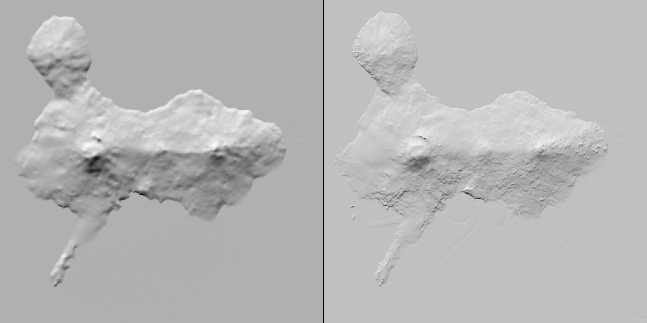
I’m working on a mesh update of Antarctica4XPlane Part 2. For this I begun to merge some high resolution elevation models into the current low resolution model. With success, as you can see below: Shown is a digital elevation model of Ross Island [the current DEM on the left and the upcoming on the right], composited out of three different sources. Each source has its weakness and voids, but in combination they result in a breathtaking improvement of the current mesh: